America's Best New Bikeways of 2020
By: PeopleForBikes Staff
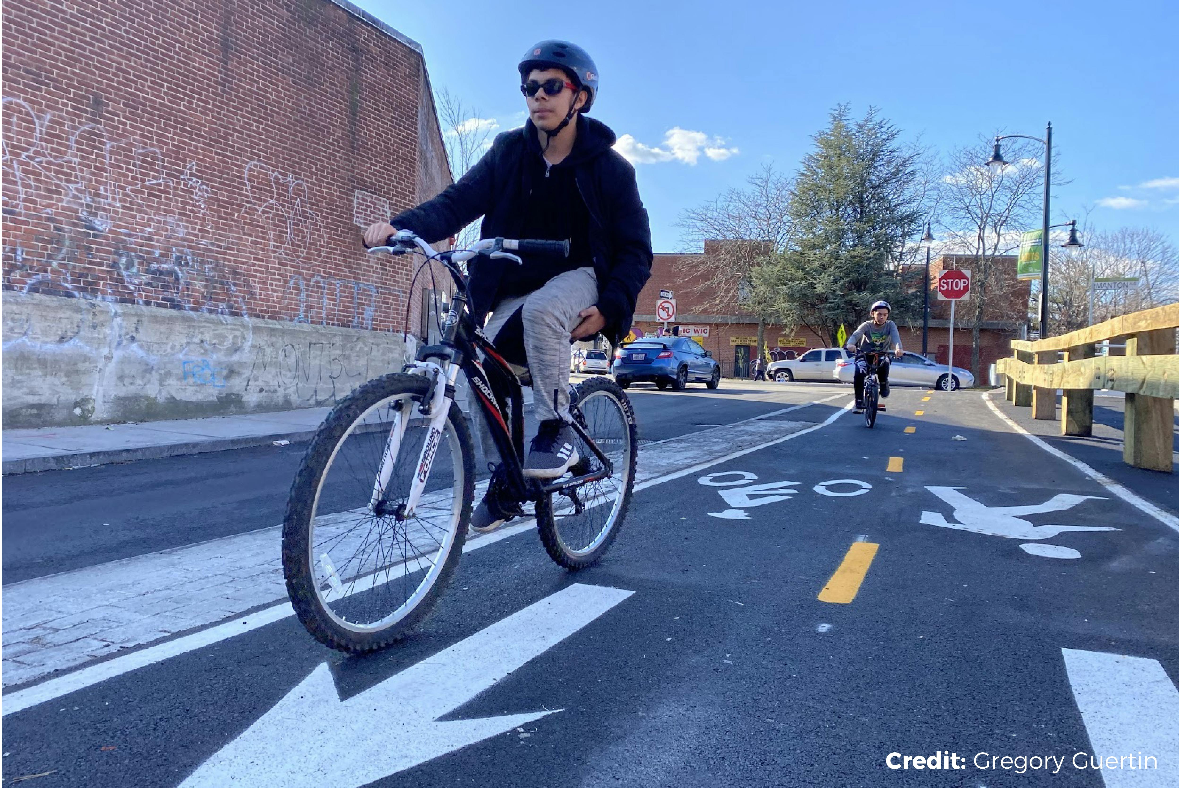
We can all agree, 2020 was tougher than anyone anticipated. As the year began, planning for a pandemic could only be described as a fantastical thought exercise, but by March the realities of COVID-19 reached all corners of America, dramatically changing nearly every aspect of people’s lives.
As our nation grappled with sustained solutions for controlling the spread of the virus, something special happened — Americans returned to bicycling as a safe, healthy method of recreation and transportation.
During the COVID-19 pandemic, 10% of American adults engaged with bicycling in a new way. 4% of the US population (ages 18 and older) rode a bicycle for the first time in one or more years, or for the first time ever. An additional 6% participated in a different type of bicycling during the pandemic, trying indoor riding or riding their bike for transportation.
Local surges in bicycling activity were seen across the U.S., and cities responded.
By April, more than 200 U.S. cities temporarily changed the layout of their streets — eliminating through traffic, slowing cars and opening roadways for people of all ages and abilities to comfortably enjoy the outdoors while city parks, fitness centers and schools were closed.
While no American city accelerated temporary pop-up bike lane networks at the same scale as those lauded in Berlin, Bogota or Paris, U.S. city leaders did something else amazing — they continued to build permanent bikeways that position bikes as a solution to many of the challenges our communities face, now and in the future.
These projects make biking more useful, more beautiful and more welcoming to all riders. With careful planning and smart construction, cities relied on support from residents to expand access to completely connected, comfortable mobility networks, allowing people on bikes or on foot to travel safely throughout their community. Thankfully, these changes will last well beyond this pandemic.
In celebration of these accomplishments, here are the best new bikeways we found in 2020:
1. Algiers Protected Bike Lane Network (New Orleans, LA)
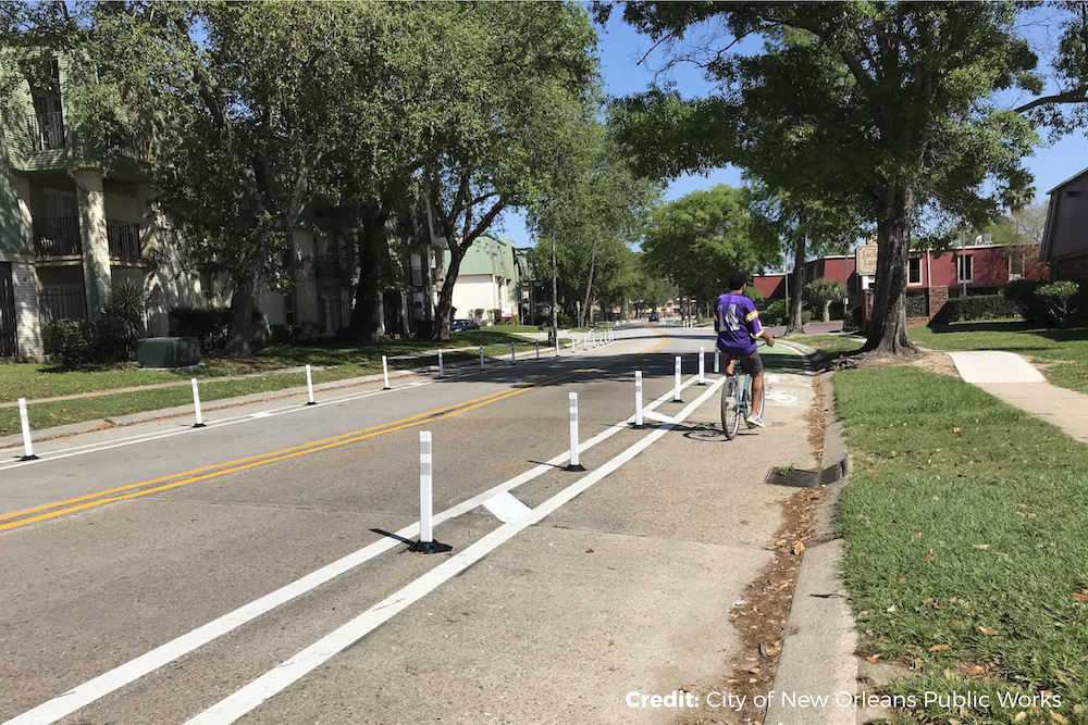
Our favorite bikeway of 2020 isn’t really a bikeway at all — it’s 11 different corridors that make up New Orleans’ protected bicycle lane network in the Algiers neighborhood.
Following the conclusion of a city-wide bicycle network planning effort called Moving New Orleans: Bikes, city leaders quickly moved into project development, working alongside a coalition of neighborhood advocates to design and build support for this network. Inspired by the story of Sevilla, Spain, city officials coordinated public input, design and construction as a unified project.
Construction of the network began in November 2019 and faced delays in 2020 as early outbreaks of COVID-19 hit the city hard. However, by summer 2020, construction was back on track and today the network stands a testament to what can be achieved with thoughtful community engagement and dedicated leadership.
“We have reaffirmed our commitment that even as we continue to respond to the COVID-19 outbreak, the infrastructure work continues around this city,” said New Orleans Mayor LaToya Cantrell. “One year ago we began in earnest the plan to expand our bikeway network in order to provide safer, more accessible and equitable transportation options. Now we’re seeing the results of strong community engagement and thoughtful planning on the ground in Algiers with the improvements along Garden Oaks — one of 11 different corridors on the Westbank.”
The bikeways themselves aren’t flashy. Designers will note the use of low-cost materials with plenty of potential for future upgrades that improve the functionality and aesthetic of each corridor. However, the sheer ambition of this work, the speed at which the city has moved and the determination to deliver high-quality projects to one of the city’s most often neglected neighborhoods is worth the top spot in our list.
Take a ride on these new bikeways using Ride Spot: https://ridespot.org/rides/247844
2. ‘Connect Downtown’ Protected Bike Lane Network (Boston, MA)
Staying with our theme of connected bicycle networks…
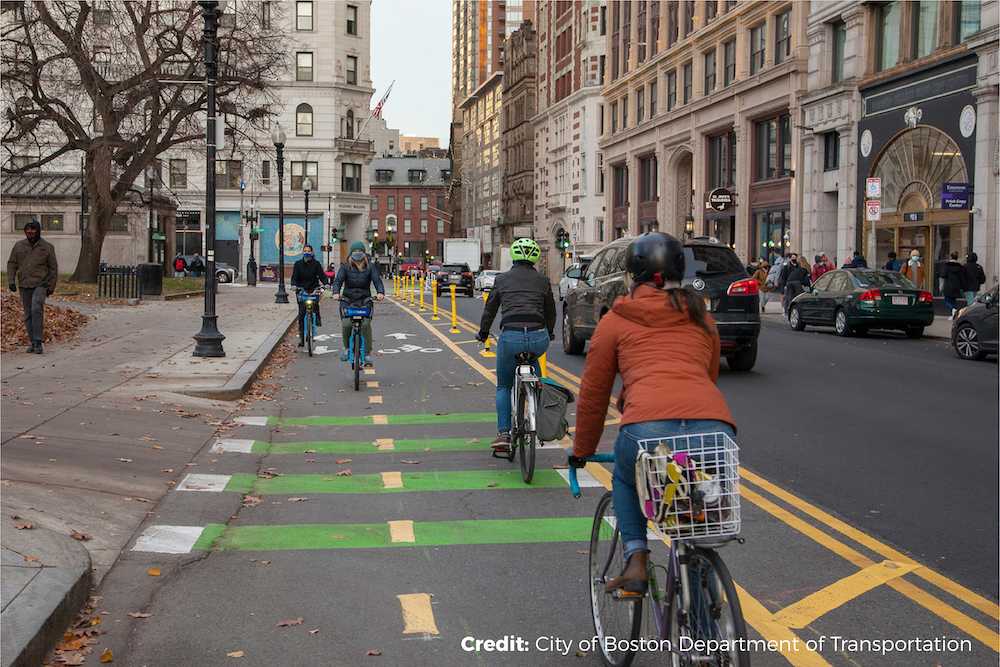
Beginning in the fall of 2019, the City of Boston’s ambitious Connect Downtown project sought to center the experiences of people — residents, commuters, and tourists — in a redesign of iconic streets in the city’s downtown neighborhoods. Planned bike network improvements looked to improve connectivity, access and safety for all riders, regardless of age or ability.
Rather than allow COVID-19 to derail this comprehensive public engagement process, city leaders embraced the moment and looked for new opportunities to maintain the momentum and strengthen community support for the improvements.
By summer, city leaders had implemented a network of “pop-up” separated bike lanes on seven of the Connect Downtown corridors. They changed traffic signals and used orange traffic barrels to provide space for bicycling on these major roadways. “Safe and reliable transportation, especially for our essential workers and commuters, is one of our top priorities as we respond to the COVID-19 pandemic,” said Boston Mayor Marty Walsh.
Prompted by the success of these temporary bike lanes and the positive feedback from city residents, Boston’s Department of Transportation began construction in October on 2.5 miles of permanent separated bike lanes on the streets surrounding the Public Garden and the Boston Common areas.
In order to best serve the families who live in these neighborhoods, the new bike lanes are at least 7 feet wide, allowing for side-by-side bicycling and the use of larger cargo bikes and adult tricycles. People riding bikes will also see new bike signals at four major intersections.
Take a ride on these new bikeways using Ride Spot: https://ridespot.org/rides/247887
3. ‘Gap to the Point’ Protected Bike Lane Network (Pittsburgh, PA)
Complete bike networks continue to fill our top picks…
For anyone that has ever biked in downtown Pittsburgh, you’re probably aware that this part of the city is the nexus of two of the nation’s most iconic cycling destinations — Point State Park and the Great Allegheny Passage (GAP) trail system that connects long-distance riders to Washington, D.C. What you might not know, however, is that until this year, there was no direct bicycling route connecting these two important landmarks.
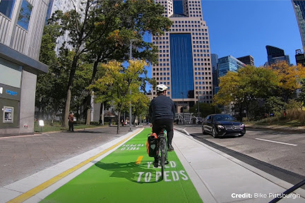
Improvements led by the City of Pittsburgh’s Department of Mobility and Infrastructure (DOMI), the Downtown Pittsburgh Partnership and other stakeholders have completed the final on-street connections that guide riders through the heart of Downtown Pittsburgh.
Recently completed projects along Stanwix St. and Liberty Ave. combine with existing protected bike lanes along Smithfield St., 3rd Ave. and Penn Avenue to connect the GAP trail near the Smithfield St. bridge to Point State Park. The Stanwix St. and Liberty Ave. bike lanes have both concrete and bollard protection and feature innovative work around several bus stops, making it easier for buses to pull up directly to the curb.
The intersections offer dedicated bike signals, complete with radar that detect when a person on a bike is waiting. While there are a few design elements yet to be completed (like replacement of the temporary asphalt ramp with a permanent curb cut entering Point State Park), riders can now rest (and bike) easy knowing that navigating PIttsburgh’s bustling downtown streets just got a lot easier.
Take a ride on these new bikeways using Ride Spot: https://ridespot.org/rides/247994
4. Shoal Creek Boulevard (Austin, TX)
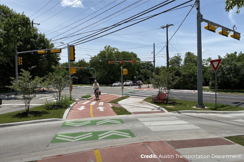
The 5.5-mile protected bikeway on Shoal Creek Boulevard fills a gap in the proposed 30-mile Big Loop trail network around central Austin. To create space for people walking and biking, the Austin Transportation Department led extensive community outreach in 2019 to build support for the removal of on-street automobile parking from one side of the residential corridor and a five-to-three lane conversion on the other half.
While this street has been a long-time route for recreational cyclists, there was previously no dedicated space for people to bike. Adding delineators, concrete buttons and protected intersections made this street appropriate for riders of all ages and abilities, just in time for the pandemic-related need for social distancing and access to the outdoors.
Take a ride on Shoal Creek Boulevard using Ride Spot: https://ridespot.org/rides/248003
5. The Hampline – Broad Street and Tillman Street (Memphis, TN)
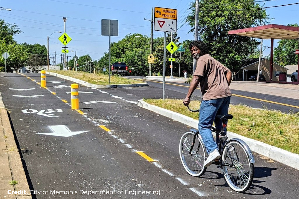
The Hampline is a two mile long corridor that effectively extends the Shelby Farms Greenline — Memphis’ first and longest greenway — connecting Overton Park and Shelby Farms Park (one of the largest urban parks in the country at 4,500 acres). The project started in 2010 as a grassroots effort by local business owners and residents who used pop-up bike lanes and tactical urbanism to reimagine their streets. Later on, when the project stalled due to a lack of sufficient funding for design, hundreds of individual Memphians crowdsourced $75,000 allowing the work to proceed.
The project features raised medians separating a two-way cycle track from automobiles, enhanced on-street pedestrian crossings, landscaping and Memphis’ first bicycle-specific traffic signals. In addition to seamlessly linking the most popular outdoor spaces in Memphis, the Hampline was supported by community leaders in the Binghampton neighborhood — a predominantly low-income community of color that has experienced decades of disinvestment — to improve access to the local parks and trails at their doorstep.
Take a ride on The Hampline using Ride Spot: https://ridespot.org/rides/248004
6. Walnut Avenue Bikeway (Fremont, CA)
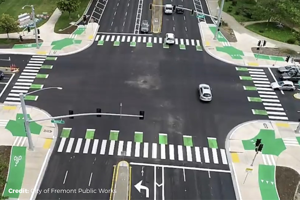
The 1.2-mile Walnut Avenue Bikeway is a new, signature facility in the Bay Area city of Fremont, CA. Extending from Mission Boulevard to Paseo Padre Parkway, this corridor has one of the highest levels of biking in the city and connects to the Fremont BART station, housing and local businesses.
Designed with community in mind, the Walnut Avenue Bikeway is safe and easy to use for all members of the community and surrounding area.
Raised cycle tracks ensure the safety and comfort of bicyclists by positioning them at the sidewalk level where they are physically separated from vehicles. The corridor also features four protected intersections, shortening crossing distances for pedestrians and bike riders, slowing the speeds that automobiles can turn, improving the positioning and visibility of bikes and pedestrians and eliminating the need for bikes to mix with high-speed traffic in order to make turns.
Take a ride on the Walnut Avenue Bikeway using Ride Spot: https://ridespot.org/rides/248005
7. First Street (Ann Arbor, MI)
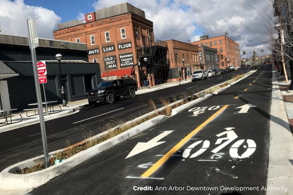
The City of Ann Arbor, working alongside the Ann Arbor Downtown Development Authority (DDA), reconfigured several city streets this year to implement the city council’s commitment to vision zero, carbon neutrality and improved equity and access. Among the improvements, a redesign of First Street was a critical addition to Ann Arbor’s network of bicycle paths.
The First Street Bikeway creates a low-stress corridor on the west side of downtown and connects to the existing protected lane on William Street and the future The Treeline – Allen Creek Urban Trail. Using lessons learned while developing the William Street Bikeway (opened in 2019), the DDA increased protection for bicyclists by implementing physical barriers, raising the cycle track and slowing car traffic. The DDA widened sidewalks and beautified the corridor, adding new greenery, benches and lamp posts.
Five blocks of the protected bicycle highway are now open between William Street and Miller Avenue. Some finishing touches remain for the stretch north of Huron, and construction will continue into 2021 on another section north of Miller Ave..
Take a ride on the First Street Bikeway using Ride Spot: https://ridespot.org/rides/248006
8. Milwaukee Avenue (Chicago, IL)
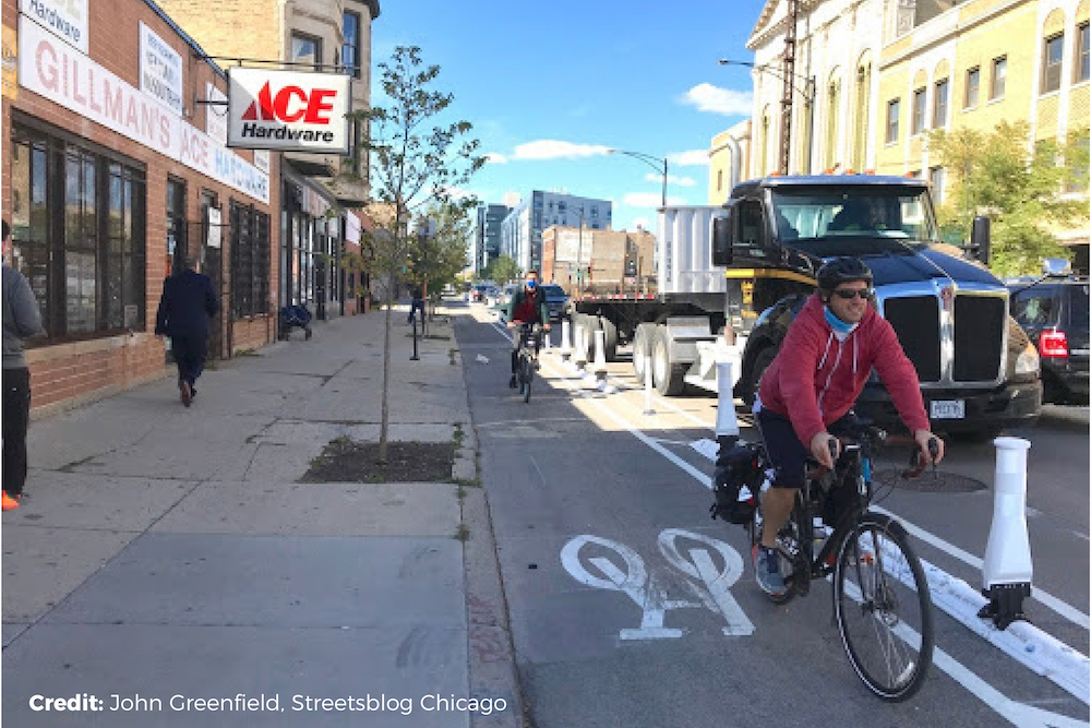
The Milwaukee Ave. protected bike lane, between Western and California in Logan Square, is one of Chicago’s busiest biking thoroughfares, connecting to a network of other existing bikeways and public transportation hubs.
Building this protected bike lane was no easy feat — creating the space needed to prioritize safe biking required city leaders to relocate 60% of the on-street automobile parking to nearby locations. Working closely with businesses along the 0.75-mile corridor, project managers were able to maintain critical business operations during and after construction, all while improving accessibility for the entire neighborhood regardless of how people choose to move around.
The new design prioritizes the safety of the most vulnerable users (two-thirds of all injury-producing crashes in the city involve people walking and biking) and better reflects how the community already uses the street (bike riding in Logan Square is growing much faster than the city average). Project features include “qwik kurb” delineators, pedestrian bump-outs, green pavement markings at intersections and bike boxes. To better accommodate the corridor’s transit riders, new boarding islands will be installed in 2021.
Take a ride on the First Street Bikeway using Ride Spot: https://ridespot.org/rides/248233
9. West 13th/14th Avenue Couplet Protected Bike Lanes (Denver, CO)
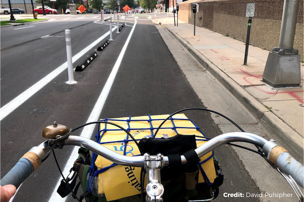
Completing nearly 40 miles of new bikeways in 2020, Denver is already delivering on Mayor Michael Hancock’s commitment to create 125 miles of new bikeways during the next five years.
Among the finished projects in 2020 is a new protected bike lane along West 13th Avenue from N. Lincoln St. to the Platte River Trail. Along with its couplet along West 14th Avenue, this bikeway serves as a crucial connection between downtown Denver, the Cherry Creek Trail and the South Platte River Trail.
To create space for this bikeway and create the buffer space necessary to reduce potential conflicts between bicycles and cars and increase the appeal for all users, city leaders repurposed and converted a combination of on-street parking and automobile travel lanes.
As with some of our other best bikeways this year, the design is solid without any frills or fuss, but you’d be hard pressed to find a project of this length and scope that increases connectivity or expands the reach of a bikeway network more than West 13th Avenue.
Take a ride on the West 13th/14th Avenue Couplet using Ride Spot: https://ridespot.org/rides/248236
10. San Souci Drive (Providence, RI)
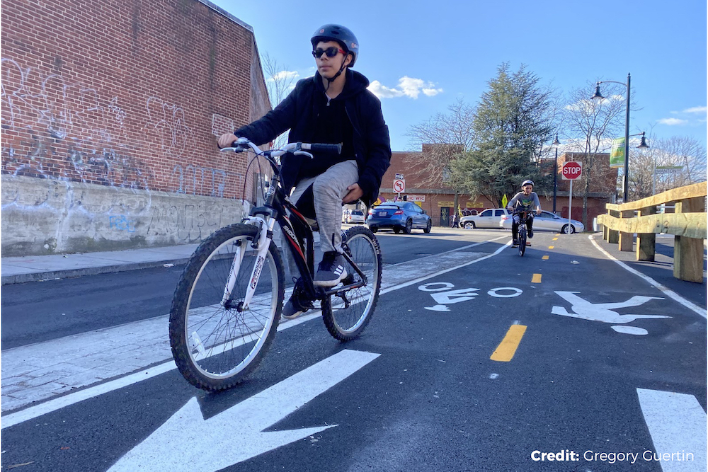
Don’t judge a project by its size. The 0.35-mile San Souci Drive is a great example of how Providence is using green infrastructure to separate space between people on bikes and others driving cars, all while mitigating local flooding and stormwater runoff into the Woonasquatucket River — one of just fourteen American Heritage Rivers in the country.
Located between a hub of local businesses in Olneyville Square and the banks of the Woonasquatucket River, this project is part of a larger plan to better connect the seven-mile Woonasquatucket River Greenway to the surrounding Olneyville neighborhood where nearly 30% of households do not own a car.
As part of the project, the city reduced the width of San Souci Drive, reallocating space from 16-foot-wide travel lanes to make room for a landscaped bioswale containing trees, ornamental grasses and other plantings that minimize stormwater runoff and flooding while beautifying the area. Despite the changes, access for loading and parking was maintained for all businesses along San Souci Drive, and the new separation treatments make walking and biking safer for all members of the community.
The project is also part of Providence’s much larger Urban Trail Network initiative, which will connect the state’s numerous regional trial systems and the city’s urban neighborhoods.
Take a ride on the San Souci Drive using Ride Spot: https://ridespot.org/rides/248237
HONORABLE MENTION: South Congress Avenue (Austin, TX)
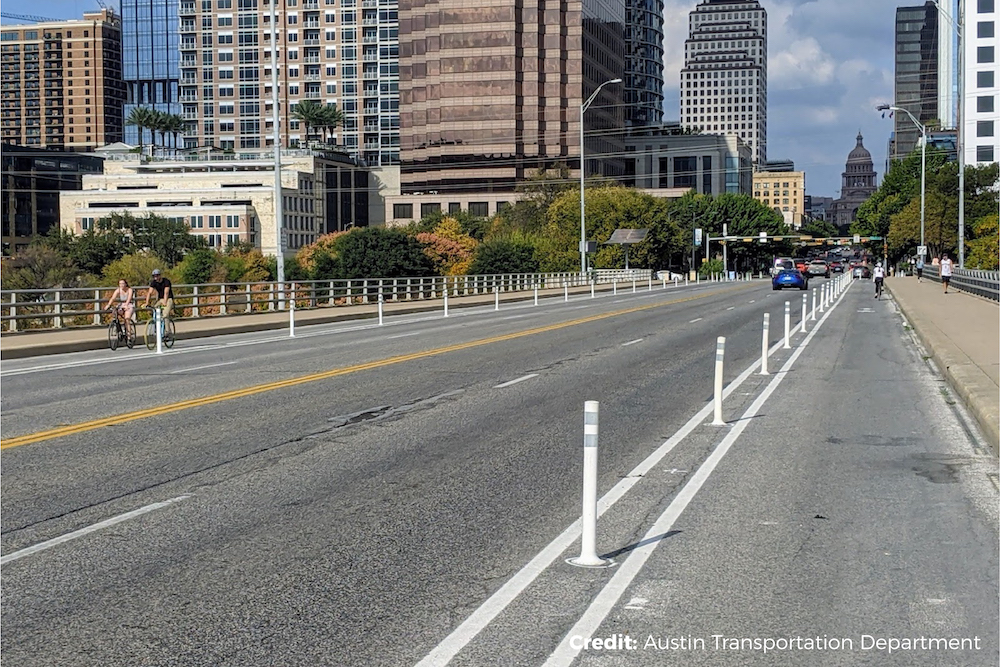
This past summer, in an effort to improve safety and address COVID-19 risk-based guidelines for mobility and business, the Austin City Council unanimously supported the creation of temporary protected bicycle lanes on South Congress Avenue from Riverside Drive to 11th Street.
South Congress Avenue is considered the “Main Street of Texas,” with leading views toward the Texas State Capitol and direct connections to both the natural and urban spaces of Austin. Many different design options have been presented publicly over the last 10 years, but all faced stiff opposition from business owners and other stakeholders with interests in the corridor.
Following the fatal crash of a bicyclist in 2012, discussions to improve the corridor and make it safe for users of all Austin residents were making significant progress through the multi-year Congress Urban Design Initiative, but were anticipated to face delays. This year, prompted to take action by the pandemic, city leaders expedited the implementation and moved towards permanence in November 2020.
Orange traffic cones placed last summer to denote the protected bike lanes were replaced with painted striping, white delineator posts, protected intersections and a reduction in the number of automobile travel lanes. Now, the project that started as a temporary COVID relief has made substantial multimodal and safety improvements that will sustain riders well into the future.
Take a ride on the South Congress Avenue using Ride Spot: https://ridespot.org/rides/248238
Related Locations:
